Log in
All resources
Create a design
1,693 Free Artworks of Historic Map
gemeente atlas van nederland - south holland
1860s maps of south holland
maps of paris from the david rumsey historical map collection
atlas du canton de paris, 1795
composite map
david rumsey historical map collection
gemeente atlas van nederland - north holland
1860s maps of north holland
historisk atlas (stockholm, norstedt & söner, 1880)
baroque
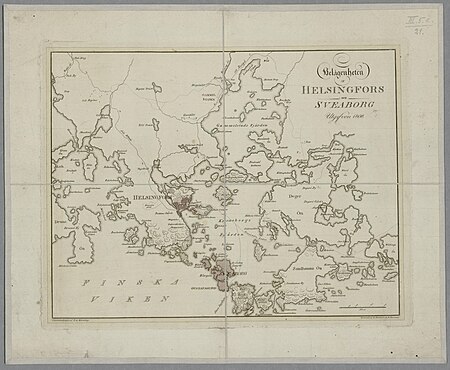
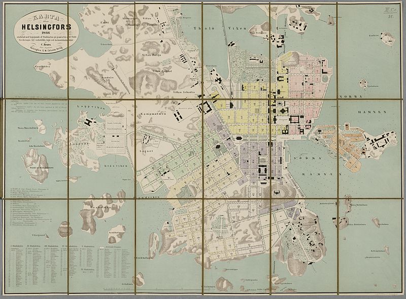
media from the national library of finland
classicism
arabian expedition (1761-1767)
historical images of yemen
media from the national library of finland
classicism
ross township, butler county, ohio
hill forts in the united states
gemeente atlas van nederland - south holland
19th-century maps of rotterdam
gemeente atlas van nederland - south holland
old maps of dordrecht
gemeente atlas van nederland - south holland
old maps of gorinchem
gemeente atlas van nederland - south holland
maps of maassluis
gemeente atlas van nederland - south holland
1860s maps of south holland
gemeente atlas van nederland - south holland
1860s maps of south holland
gemeente atlas van nederland - north holland
maps of haarlemmermeer
turgot map of paris, kyoto university library – derivative files
historical images of palais bourbon
media from the national library of finland
classicism
1810s maps of the near east
maps by john cary
gemeente atlas van nederland - south holland
1860s maps of south holland
gemeente atlas van nederland - south holland
1860s maps of south holland
gemeente atlas van nederland - south holland
1860s maps of south holland
eric (xii) of sweden (erik magnusson)
maps of the history of sweden
maps of the ottoman empire by mercator-hondius
eran laor cartographic collection
gemeente atlas van nederland - north holland
old maps of beverwijk
maps of paris from the david rumsey historical map collection
maps of paris by caspar merian
maps by thomas kitchin
andrew dury
maps of the history of palestine
1880s maps of palestine
maps of paris from the barry lawrence ruderman antique maps inc.
key sheet of the turgot map of paris
media from the national library of finland
classicism
atlas du canton de paris, 1795
plan de roussel
gemeente atlas van nederland - south holland
1860s maps of south holland
gemeente atlas van nederland - south holland
1860s maps of south holland
gemeente atlas van nederland - south holland
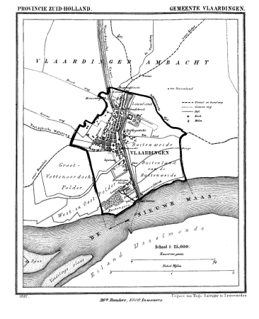
old maps of vlaardingen
gemeente atlas van nederland - south holland
1860s maps of south holland
gemeente atlas van nederland - south holland
1860s maps of south holland
turgot map of paris, kyoto university library – derivative files
porte saint-antoine
maps of the ottoman empire by mercator-hondius
eran laor cartographic collection
maps of paris from the barry lawrence ruderman antique maps inc.
plan de turgot
ancienne église saint-hippolyte de paris
churches on turgot map of paris
maps of the ottoman empire by mercator-hondius
eran laor cartographic collection
gemeente atlas van nederland - south holland
1860s maps of south holland
gemeente atlas van nederland - south holland
1860s maps of south holland
gemeente atlas van nederland - north holland
old maps of haarlem
topographia westphaliae (merian)
baroque
maps of the umayyad caliphate (damascus)
old maps of the caliphate
maps of the history of sweden
1386 in sweden
gemeente atlas van nederland - north holland
amsterdam in the 1860s
gemeente atlas van nederland - north holland
19th-century maps of amsterdam
historisk atlas (stockholm, norstedt & söner, 1880)
maps showing 843
maps of paris from the david rumsey historical map collection
atlas du canton de paris, 1795
maps of paris from the david rumsey historical map collection
atlas du canton de paris, 1795
topographia westphaliae (merian)
baroque
old maps of north holland
old maps of kennemerland
maps of paris from the david rumsey historical map collection
atlas du canton de paris, 1795
maps of paris from the david rumsey historical map collection
atlas du canton de paris, 1795
maps of paris from the david rumsey historical map collection
atlas du canton de paris, 1795
maps of the ottoman empire by mercator-hondius
eran laor cartographic collection
cartes de franz schrader
1894 maps of france
maps of paris from the david rumsey historical map collection
atlas du canton de paris, 1795
maps of paris from the david rumsey historical map collection
atlas du canton de paris, 1795
maps of paris from the david rumsey historical map collection
atlas du canton de paris, 1795
maps of paris from the david rumsey historical map collection
atlas du canton de paris, 1795
maps of paris from the david rumsey historical map collection
atlas du canton de paris, 1795
maps of paris from the david rumsey historical map collection
atlas du canton de paris, 1795
gemeente atlas van nederland - south holland
1860s maps of south holland
turgot map of paris, david rumsey historical map collection – derivative files
historical images of place des vosges
turgot map of paris, david rumsey historical map collection – derivative files
historical images of église saint-sulpice
historical images of île de la barthelasse
villeneuve-lès-avignon
maps of san juan, puerto rico
san juan bay, puerto rico
a plan of the operations of the king's army under the command of general sr. william howe, k.b. in new york and east new jersey, against the american forces commanded by general washington, from the 12th. of october, to the 28th. of november 1776
old maps of new york (state) from the norman b. leventhal map center
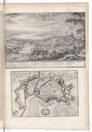
old maps of geneva
baroque
grigory anikiyevich kachalov
mikhail makhaev
parts of old maps of hamburg
maps of hamburg-altstadt
merian mainz trier köln
baroque
gemeente atlas van nederland - south holland
1860s maps of south holland
gemeente atlas van nederland - south holland
1860s maps of south holland
gemeente atlas van nederland - south holland
19th-century maps of rotterdam
maps in the library of congress
old maps of connecticut
maps from the mechanical curator collection available to georeference
maps from the mechanical curator collection
maps showing history of the early middle ages
charles the bald
maps by thomas kitchin
andrew dury
historical images of somalia
fra mauro map details
historical images of rapperswil-jona
topographischer atlas der schweiz
topographia westphaliae (merian)
baroque
gemeente atlas van nederland - south holland
1860s maps of south holland
gemeente atlas van nederland - south holland
maps of heerjansdam
gemeente atlas van nederland - south holland
1860s maps of south holland
gemeente atlas van nederland - south holland
1860s maps of south holland
gemeente atlas van nederland - south holland
old maps of eiland van dordrecht
1673 in new york city
24 august
david rumsey historical map collection
andrew dury
turgot map of paris, david rumsey historical map collection – derivative files
historical images of bièvre river in paris
david rumsey historical map collection
17th-century maps of iceland
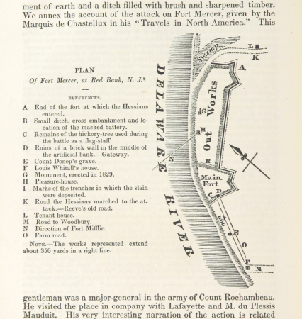
19th-century maps of new jersey
maps of the delaware river
media from the national library of finland
classicism
gemeente atlas van nederland - south holland
strevelshoek
topographia braunschweig lüneburg (merian)
baroque
maps of bamberg by braun & hogenberg
gangulphus
gemeente atlas van nederland - north holland
maps of schermer
turgot map of paris, david rumsey historical map collection – derivative files
historical images of the hôtel des invalides
gemeente atlas van nederland - south holland
1860s maps of south holland
hamburg in the 16th century
maps of hamburg-altstadt
gemeente atlas van nederland - south holland
1860s maps of south holland
gemeente atlas van nederland - south holland
maps of hendrik-ido-ambacht
701 - 800 of 1,693
Next page
/ 17